This website requires certain cookies to work and uses other cookies to help you have the best experience. By visiting this website, certain cookies have already been set, which you may delete and block. By closing this message or continuing to use our site, you agree to the use of cookies. Visit our updated privacy and cookie policy to learn more.
This Website Uses Cookies By closing this message or continuing to use our site, you agree to our cookie policy. Learn MoreThis website requires certain cookies to work and uses other cookies to help you have the best experience. By visiting this website, certain cookies have already been set, which you may delete and block. By closing this message or continuing to use our site, you agree to the use of cookies. Visit our updated privacy and cookie policy to learn more.
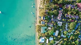
As climate change causes sea levels to rise, Florida communities can benefit from LiDAR mapping to predict storm surges and flood risk, aiding severe weather and disaster preparedness.
The Emelda Sun Club, a resort in Antalya City, Turkey, faces threats of unauthorized access from both land and sea. The resort has instituted a security plan involving radar cameras, security officers and lighting to mitigate the threats it faces.
One of the largest Sea Bass and Bream fish farms in the Mediterranean for sustainable aquaculture, Avramar, wanted to improve the security arrangements of the farms, to ensure that both their assets and their employees were well protected.
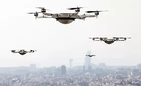
When confronting a drone (Unmanned Air Vehicle/Unmanned Air System) operating in or around their area of responsibility in an unsafe manner, most people would like to bring it down immediately. Unfortunately, in most situations, it is unlawful to interfere with the flight path of a drone. The most important response that can be done legally is detection.
For remote or unmanned facilities, getting early warning of possible intruders could make the difference in stopping a theft or other malicious security breach.