Roughly 25% of U.S. critical infrastructure is at risk of flooding
A new report highlighting the flood risk over a 30 year period for every city and county across the conterminous United States has been released by First Street Foundation, a science and technology nonprofit organization.
The nationwide, community-level flood resilience report, titled “The 3rd National Risk Assessment: Infrastructure on the Brink,” calculates the risk of five key dimensions of community risk: residential properties, roads, commercial properties, critical infrastructure and social infrastructure. Using the operational flood threshold for each building or piece of infrastructure, the Foundation was able to calculate each dimension’s specific risk of failure and aggregate those findings for every U.S. neighborhood, zip code, city and county.
The new study evaluates flood risk to critical infrastructure, such as utilities, airports, ports and emergency services, in addition to residential properties, commercial properties, roadways and social infrastructure like schools and government buildings. The findings are also incorporated into Flood Factor, a website providing Americans with an expanded scope through which to understand their personal flood risk as well as the vulnerability of their broader community.
Critical infrastructure under threat of flooding
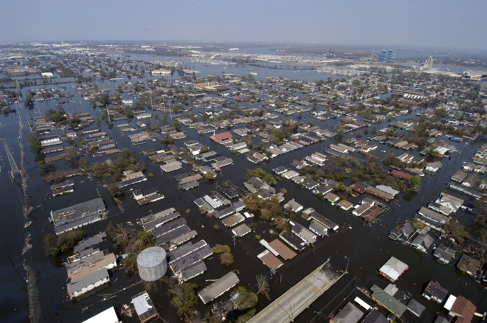
Roughly 25% of all critical infrastructure in the country currently experiences some risk of becoming inoperable, which represents roughly 36,000 facilities. Further, 23% of all road segments in the country (nearly 2 million miles of road), are at risk of becoming impassable. Additionally, 20% of all commercial properties (919,000), 17% of all social infrastructure facilities (72,000) and 14% of all residential properties (12.4 million) also have operational risk due to flooding.
Over the next 30 years, due to the impacts of climate change, an additional 1.2 million residential properties, 66,000 commercial properties, 63,000 miles of roads, 6,100 pieces of social infrastructure and 2,000 pieces of critical infrastructure will also have flood risk that could render them inoperable, inaccessible or impassable.
The highest concentration of community risk exists in Louisiana, Florida, Kentucky, and West Virginia, with 17 of the top 20 most at risk counties in the U.S. (85%) residing in these 4 states. Louisiana alone accounts for 6 of the top 20 most at risk counties (30%).
Suggested industry uses of this data
The report suggested the following ways that property owners, enterprises and government bodies can best utilize the flood risk data provided by the study.
- Property owners can mitigate their risk by buying insurance from federal or private providers, buying properties with lower risk, or investing in flood-proofing their property.
- Real estate, mortgage, insurance and investment communities can judge the flood risk of the properties under their control and adjust actuarial estimates for specific buildings and structures based upon data in the report.
- Governmental bodies and lawmakers can use this data to inform policy that mitigates flood risk, including climate change legislation, property buyouts, public works that reduce community risk and adapting current infrastructure to be better protected against flooding.
Find more results in the full report.
Looking for a reprint of this article?
From high-res PDFs to custom plaques, order your copy today!